|
|
|
|
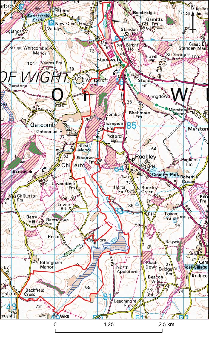
IWBOA: Upper Medina Valley
This map is based on Ordnance Survey material with the permission of Ordnance Survey on behalf of the Controller of Her Majesty's Stationery Office © Crown copyright. Unauthorised reproduction infringes Crown copyright and may lead to prosecution or civil proceedings. 100019229 2008.

Opportunity area description
River valley south of Newport as far as Chale Green.
Joint Character Area/Landscape descriptive unit
Isle of Wight Joint Character Area: Intensive arable land, sandstone hill and gravel ridges.
Landscape types
Rolling arable farmland, with scattered woodland in a wide valley.
Geology (bedrock)
Mudstone, sandstone, and ferruginous sands.
Geology (superficial)
Extensive alluvium and peat deposits.
Topography (landform)
Narrow stream heavily modified by river engineering crosses a wide sandstone vale. Irrigation storage reservoirs have been constructed in several places.
Biodiversity ( BAP habitat, Designated sites UK BAP Species)
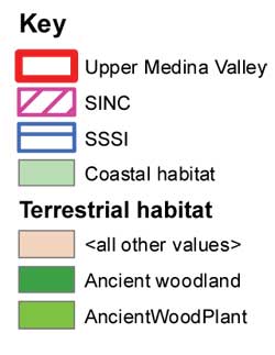
SSSIs : The Wilderness, Cridmore Bay
SINCs: Billingham Manor Farm, Sibdown Farm Copse, Gatcombe Withybed, River Medina: Shide to Blackwater
BAP habitat
UK BAP Species
Water vole; Cornflower; Skylark; Yellowhammer; Linnet; Woodland Bats
Access
Footpaths cross the area, but no access along the length of the river.
Targets – main opportunities
| home | partnership | habitats | species | biodiversity opportunity areas | benefits of biodiversity |
biodiversity & you | advice | walks & events | library | contact |