|
|
|
|
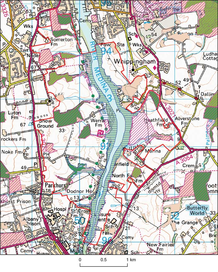
IWBOA: Medina Estuary
This map is based on Ordnance Survey material with the permission of Ordnance Survey on behalf of the Controller of Her Majesty's Stationery Office © Crown copyright. Unauthorised reproduction infringes Crown copyright and may lead to prosecution or civil proceedings. 100019229 2008.

Opportunity area description
The rural areas of the Medina Estuary between Newport and Cowes.
Joint Character Area/Landscape descriptive unit
IW Joint Character Area: Harbours and creeks, traditional enclosed pasture, landscape improvement area.
Landscape types
Tidal estuary surrounded by farmland, predominantly arable with some pasture, and scattered ancient and secondary woodlands joined by hedgerows.
Geology (bedrock)
Hamstead beds.
Geology (superficial)
Alluvium.
Topography (landform)
Shallow valley with tidal estuary, saltmarsh and mudflats. Small streams draining into the estuary.
Biodiversity ( BAP habitat, Designated sites UK BAP Species)
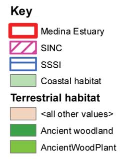
SSSIs : Medina Estuary
SINCs:Cowes Cemetery and Woods, Calvingclose Copse, Simmington Copse, Waterclose Copse, Great Werrar Wood, Little Werrar Wood, Werrar Meadow, Stag Copse, Stag Lane Pond, Dodnor Creek, Blackbush Copse, Heathfield Farm, Heathfield Copse
BAP habitat
UK BAP Species
Curlew (wintering); Black-tailed godwit (wintering), Lapwing (wintering); Brent goose (wintering); Red squirrel; Dormouse; White Admiral; Reed bunting; Herring Gull; Starling (winter roost).
Access
Cycleway on western side, footpaths on eastern side, linking to make a circular walk.
Targets – main opportunities
| home | partnership | habitats | species | biodiversity opportunity areas | benefits of biodiversity |
biodiversity & you | advice | walks & events | library | contact |