|
|
|
|
wetlands
Find out more
The freshwater habitats on the Isle of Wight are all the more precious and unusual for their scarceness and isolation from the mainland.Habitat Action Plans
Lowland
Meadows HAP (2002)
Wetlands
HAP (2011)
External links
RSPB
Brading Marshes
Medina Valley Centre
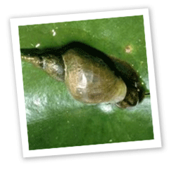
Pond snail (c) IWNHAS The Island has little in the way of freshwater habitat compared
with the mainland, nevertheless there are still a number of important areas,
including one of the largest areas of grazing marsh in Southern England (Brading
Marshes).
The rivers and streams are of interest because they are not connected to any mainland systems, and so are sometimes without species which are found as a matter of course in mainland waterways. The isolation from the mainland has meant that, to date, the Island is the only county in England without a feral mink population and this may be linked to the presence of high populations of water vole and some waterfowl.
The Island has a diverse wetland resource, but it is highly fragmented and the sites are generally small and of poor quality. Isle of Wight rivers are small and generally slow-flowing. With the exception of the Eastern Yar and a few small brooks on the south coast, all other streams flow north to the Solent. Several rivers including the Medina and Eastern Yar, the Islands two largest rivers, rise as chalk springs near St. Catherine’s Down at the southern tip of the Island.
Wetlands are dynamic semi-natural systems and much of the Island resource of fen and marsh has now degraded to reed-dominated tall fen. In addition, much of the reedbed resource has been created by the flooding of abandoned low-lying pasture. As a result, there has been an increase in poor quality reedbed since the last War, and a decrease in good quality wetland habitats, exacerbated by changes in river engineering and drainage.
Afton Marsh Local Nature Reserve
Afton Marsh Local Nature Reserve, owned and managed by Isle of Wight Council parks and countryside section, is a 15ha wetland reserve on low-lying land behind Freshwater Bay. Part of the Western Yar flood plain, this land was once grazed by cattle but ceased to be grazing marsh many decades ago. Management is targeted at keeping the site wet, and holding back the relentless succession to scrub and woodland.
Many good wetland sites that are left, such as Cridmore and the bogs of Bohemia and Munsley are still threatened by inappropriate landuse of surrounding land or management of the water courses.
Eastern Yar Bogs
Natural Enterprise has been working in the Eastern Yar river catchment to dramatically improve tiny, fragile fragments of species-rich mires which have suffered from the slow invasion of woody species in recent years.
At Bohemia Bog, a tiny mire perched on a hillside where the acid water leaves the gravel ridge, gorse has been scraped away, more than doubling the area of the bog. Specialities such as sundew and pale butterwort have responded well, increasing and spreading across the site.
At Munsley Bog, a shallow peaty valley, birch has been removed to help sustain the remaining bog myrtle and cross–leaved heath, and new propagations from these last remnants are being reintroduced.
Key Sites
Afton Marsh Local Nature Reserve
Brading Marshes
East Yar Valley
Cridmore Bog
Bohemia Bog
Munsley Bog
Sites in the East Yar valley and Medina are at risk through pollution and sedimentation, as a result of intensive agricultural activity on the river edge. Because of the scarcity of fen and swamp habitat, many species associated with these habitats are locally rare or have become extinct. Indeed, it is considered that this habitat has suffered the greatest number of local extinctions over the last two hundred years. Although the Island is comparatively well-off for reedbeds, the lack of large good quality sites has contributed to a paucity of reedbed specialist species.
The most extensive wetland habitats on the Island are found within the Eastern Yar Valley. These include the internationally important wetlands of Brading Marshes SSSI that form part of the Solent and Southampton Water Ramsar Site. Brading Marshes are of comparatively recent origin, having being claimed from the sea at the end of the 19th century. They comprise extensive areas of coastal and flood plain grazing marsh, together with smaller areas of marshy grassland, swamp and reed bed.
| home | partnership | habitats | species | biodiversity opportunity areas | benefits of biodiversity |
biodiversity & you | advice | walks & events | library | contact |